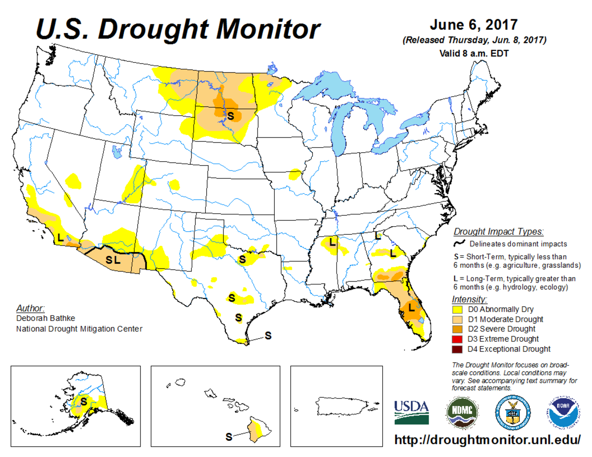
According to the June 6, 2017, U.S. Drought Monitor, moderate to severe drought covers 7.8% of the contiguous United States, an increase from last week’s 5.3%. Extreme drought was completely eliminated from the lower 48 states for the first time since May 2010. And exceptional drought, the worst category, continued to remain absent for the 20th consecutive week.
A high pressure ridge in the upper-atmosphere began to assert itself over the contiguous United States this U.S. Drought Monitor week. But, upper-level troughs and closed lows continued to move through the jet stream flow.
These upper-level systems and their surface fronts brought cooler- and wetter-than-normal weather to the Southern Plains and Northeast, and above-normal precipitation to the Southeast, improving drought conditions. But, they were weakened as they moved through the upper-level ridge, with warmer- and drier-than-normal weather consequently dominating across the West, Northern and Central Plains, and Midwest. Persistent dryness in the Northern Plains resulted in expansion of drought and abnormal dryness.
The full U.S. Drought Monitor weekly update is available from Drought.gov.
In addition to Drought.gov, you can find further information on the current drought as well as on this week’s Drought Monitor update at the National Drought Mitigation Center.
The most recent U.S. Drought Outlook is available from NOAA’s Climate Prediction Center and the U.S. Department of Agriculture provides information about the drought’s influence on crops and livestock.
For additional drought information, follow #DroughtMonitor on Facebook and Twitter.


