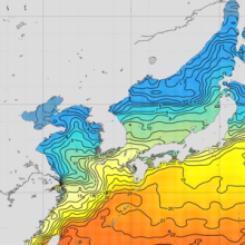
The East Asian Seas Regional Climatology Version 2.0 is an update to the preliminary May 2012 release, and includes new temperature and salinity data spanning from 1804 through 2013. The climatology is a set of objectively analyzed climatological fields of temperature and salinity at standard depth levels in the East Asian Marginal Seas.
These decadal climatologies were generated from regional data in the World Ocean Database. The datasets used are described in WOD 2013.
Citations
- Johnson, Daphne R., Boyer, Tim P. (2015). East Asian Seas Regional Climatology Version 2.0 from 1804 to 2014 (NCEI Accession 0123300). [indicate subset used]. NOAA National Centers for Environmental Information. Dataset. doi:10.7289 /V5MP5171.
- Johnson, Daphne R., Boyer, Tim P. (2015). Regional Climatology of the East Asian Seas: An Introduction. NOAA Atlas NESDIS 79, Silver Spring, MD, 37 pp., doi:10.7289/V5D21VM9.
Study Area
115°E to 143°E longitude and 24°N to 52°N latitude
Temporal Resolution
Each climatology has an annual (all-data), seasonal, and monthly time period calculation.
Seasons
Winter (Jan.-Mar.), Spring (Apr.-Jun.), Summer (Jul.-Sep.), Fall (Oct.-Dec.)
Horizontal Resolution
Temperature and salinity are available on a 1x1, 1/4, and 1/10 latitude/longitude degree grid.
Vertical Resolution
Annual and seasonal climatologies are available from the surface to 5500 meter depths. Monthly climatologies are available from the surface to 1500 meter depths.
Units
- Temperature
- °C
- Salinity
- Unitless on the Practical Salinity Scale-1978 [PSS]
- Data distribution
- Units are in number of observations in each grid box.
Bathymetry
- One-degree and 1/4-degree
- The mean of an ETOPO2 grid square
- 1/10th-degree
- The mean of an ETOPO1 grid square
Method
The methods used for calculating the mean climatological fields is described in Locarnini et al., 2013 for temperature and Zweng et al., 2013 for salinity. Additional details on the 1/4° climatological calculation are found in Boyer et al., 2005. Table 1 gives radii of influence for all three passes through the objective analysis procedure for each horizontal resolution.
| Pass | 1° radius of influence | 1/4° radius of influence | 1/10° radius of influence |
|---|---|---|---|
| 1 | 892 km | 321 km | 211 km |
| 2 | 669 km | 267 km | 155 km |
| 3 | 446 km | 214 km | 111 km |
Related Publications
- Amante, C. and B.W. Eakins, 2009. ETOPO1 1 Arc-Minute Global Relief Model: Procedures, Data Sources and Analysis. NOAA Technical Memorandum NESDIS NGDC-24. National Geophysical Data Center, NOAA. doi:10.7289/V5C8276M.
- Boyer, T., S. Levitus, H. Garcia, R.A. Locarnini, C. Stephens, J. Antonov, 2005: Objective analyses of annual, seasonal, and monthly temperature and salinity for the world ocean on a 0.25 degree grid. International Journal of Climatology, 25(7), 931-945.
- Boyer, T.P., J.I. Antonov, O.K. Baranova, C. Coleman, H.E. Garcia, A. Grodsky, D.R. Johnson, R.A. Locarnini, A.V. Mishonov, T.D. O'Brien, C.R. Paver, J.R. Reagan, D. Seidov, I.V. Smolyar, M.M. Zweng, 2013: World Ocean Database 2013. Sydney Levitus, Ed.; Alexey Mishonov, Technical Ed.; NOAA Atlas NESDIS 72, 209 pp. doi:10.7289/V5NZ85MT.
- Levitus, S., 1982: Climatological Atlas of the World Ocean. NOAA Professional Paper 13, 173 pp., U.S. Gov. Printing Office, Rockville, MD. ftp://ftp.library.noaa.gov/noaa_documents.lib/NOAA_professional_paper/NOAA_paper_13.pdf
- Locarnini, R.A., A.V. Mishonov, J.I. Antonov, T.P. Boyer, H.E. Garcia, O.K. Baranova, M.M. Zweng, C.R. Paver, J.R. Reagan, D.R. Johnson, M. Hamilton, and D. Seidov, 2013: World Ocean Atlas 2013, Volume 1: Temperature. S. Levitus, Ed., A. Mishonov Technical Ed.; NOAA Atlas NESDIS 73, 40 pp. doi:10.7289/V55X26VD.
- National Geophysical Data Center, 2006. 2-minute Gridded Global Relief Data (ETOPO2) v2. National Geophysical Data Center, NOAA. doi:10.7289/V5J1012Q.
- Zweng, M.M, J.R. Reagan, J.I. Antonov, R.A. Locarnini, A.V. Mishonov, T.P. Boyer, H.E. Garcia, O.K. Baranova, D.R. Johnson, D.Seidov, M.M. Biddle, 2013: World Ocean Atlas 2013, Volume 2: Salinity. S. Levitus, Ed., A. Mishonov, Technical Ed.; NOAA Atlas NESDIS 74, 39 pp. doi:10.7289/V5251G4D.


