Asheville GreenWorks assessed heat extremes in July 2023

The National Oceanic and Atmospheric Administration (NOAA) Climate Program Office, the National Integrated Heat Health Information System (NIHHIS), and CAPA are conducting an international heat mapping campaign in 2023 that spans 18 cities; Asheville was selected as a participant! According to NOAA, extreme heat is the number one cause of weather-related fatalities in the United States, and mapping heat across “urban heat islands” can provide information on how to more effectively manage the threat that heat poses.
In order to assist with the heat mapping project, NOAA National Centers for Environmental Information (NCEI) provided GreenWorks with the downtown Asheville Climate Normals for the warmest time of the year. Historically, the warmest day of the year for downtown Asheville is approximately July 21.
Asheville GreenWorks
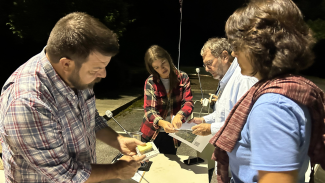
The dog days of summer are almost over, but the height of sweat-soaked shirts may not be. Heat waves across the United States have been dominating the news lately, and Asheville GreenWorks took a piece of the pie too. On Monday, July 24, 2023, a heat mapping campaign was carried out in Asheville, NC wherein volunteers conducted fieldwork.
Volunteers
Volunteers with GreenWorks were separated into three shifts to record heat and humidity in Buncombe County. Over 60 volunteers gathered in the early morning to study maps and prepare for their designated routes resembling squiggly lines. One of the challenges this summer was finding a cloudless day in which to record these values. Some clear days earlier in the month were plagued with smoke from Canadian wildfires, reducing incoming solar radiation and making it impossible to collect the needed data.
At last, mapping day arrived and volunteers covered Asheville, Arden, Woodfin, Leicester, Candler, Swannanoa, and Black Mountain—communities already experiencing heat extremes. These cities are all within a 20-mile radius of downtown Asheville.
Partnerships
GreenWorks has many core values: one of which is their belief that “many hands make light work.” GreenWorks partnered with the National Weather Service (NWS) to determine when climate conditions would be adequate for conducting the study. They also collaborated with the National Environmental Modeling and Analysis Center (NEMAC) and McCullough Institute at the University of North Carolina-Asheville (UNCA). NEMAC’s goal is to “bridge the gap between science producers and science users” to help people understand our changing planet.
GreenWorks paired up with Dr. Jackie Langille from UNCA’s Department of Environmental Studies to produce maps and analysis of these heat data—these maps will likely be ready for the public in November.
Lastly, GreenWorks will work alongside the City of Asheville to use the final heat data to target tree planting and tree canopy restoration projects in heat-vulnerable neighborhoods.
Microclimates
Asheville has many microclimates. Microclimates are part of the reason why you had to wear rainboots on your way to work whereas your coworker arrived with frizz-free hair and dry shoes. Homes in close proximity can experience very different weather conditions, precipitation, and temperatures depending on their elevation and placement relative to the surrounding mountains, rivers, and other terrain. Pavement without tree coverage can be up to 20°F warmer than nearby areas; areas with more foliage, like trees and grass, and less black asphalt are inherently at an advantage.
GreenWorks designed routes that sampled various roads, vegetation, pavement, and building density conditions throughout the greater Asheville area so that they could utilize a more comprehensive dataset.
GreenWorks Heat Mapping Results
Nicole McNeil, Marketing and Communications Manager of Asheville GreenWorks noted: “This mapping campaign will offer residents precise data on exactly which streets are the hottest and identify where heat disparities are the worst. Climate challenges are shared, but they’re not shared equally. We already know that certain neighborhoods have fewer trees and experience disproportionately severe climate impacts. By documenting the heat disparities experienced by those residents, we will be better able to co-create targeted adaptations to worsening climate impacts.”
With this data, GreenWorks will continue to work with UNCA to produce several maps and resources for the community at large.
These maps and resources may include:
- Heat Street Map: A color-shaded map will name heat disparities across the community. The best part: Data will be embedded into a searchable Google Maps interface. Residents will be able to search local heat content by typing in their address.
- Heat Health Map: GreenWorks will analyze heat data against local datasets from the Centers for Disease Control (CDC) for heart, lung and kidney disease, diabetes, asthma, and mental health—these six chronic health conditions are exacerbated by heat.
- Tree Planting Map: Heat data will be used to identify ideal locations for future tree plantings. This map resource will also pinpoint priority locations to protect existing trees. GreenWorks “hopes this resource can become the foundation for an Urban Forest Master Plan for the City of Asheville, a document that will guide the planting and preservation of Asheville’s urban trees.”
- Heat and Housing Discrimination: Heat data will be mapped against Asheville’s historic redlining and urban renewal maps to explore the environmental legacy of local discriminatory housing practices.
Watch the NCEI news site to learn more about Asheville heat mapping and see more about our Earth’s climate, oceans, coasts, and geophysics in our featured news stories. We’ll provide a follow-up web story in late fall to discuss the heat street, heat health, and tree planting maps, along with additional resources from GreenWorks.


