Less than a century ago, Jack and Jill weren’t the only ones filling buckets with water. Scientists and sailors were using wooden buckets to measure sea surface temperatures well into the 1900s. Because of their efforts, we can better understand Earth’s climate and how current events fit into longer-term historical context.
Sea surface temperature readings are taken at the top layer of the ocean—typically between 10 to 30 meters deep. And, because the ocean covers 71 percent of Earth’s surface, these temperatures help us understand how the ocean influences the global environment. Scientists use these measurements for everything from monitoring ecosystems to predicting El Niño and La Niña events.
Measuring Sea Surface Temperature with Buckets
To measure sea surface temperatures with buckets, sailors would lower them over the sides of their ships and drag them through the water until the buckets were full. Then, they would hoist them back up to the ship deck. Once the bucket was back on deck, they inserted a mercury thermometer into the water and allowed it to sit for around three minutes. They then recorded the temperature reading in the ship’s logbook.
As you can probably imagine, these measurements weren’t always the most accurate. The bucket method for measuring sea surface temperatures often led to cooler readings. This was due in part to evaporation that occurred as the bucket was hauled back onto the ship and while the thermometer was equilibrating. And, evaporation is a cooling process, which means that as it converts water from liquid to vapor, it cools the surrounding environment.
But, sailors commonly used buckets to measure sea surface temperatures up until World War II, when engine room intakes began replacing them. In fact, bucket use contributed to nearly half of all sea surface temperature measurements up until the late 1970s. According to information from the World Meteorological Organization, some ships claim to still use buckets today.
Buckets Become a Thing of the Past
Fortunately, as time progressed so did technology, allowing scientists to develop more accurate methods for measuring sea surface temperatures. Today, buoys across the ocean automatically report measurements from their sensors. These measurements are beamed to satellites for automated and immediate data distribution.
The majority of the world’s buoys are known as “drifting buoys,” which are usually attached to a drogue, a device that reduces speed or improves stability. The mechanism allows the buoys to—you guessed it—drift along with the ocean currents. Moored buoys, on the other hand, are anchored at fixed locations typically along coastlines as well as in the tropical Pacific and Indian Oceans. Whether they are drifting or moored, buoys make significant contributions to our ability to consistently monitor the ocean in remote areas.
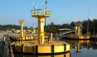
NOAA's National Data Buoy Center maintains a large network of coastal buoys in U.S. waters. These buoys range in size from around 5 feet to 40 feet in diameter—nearly seven times the height of the average American male! However, buoys aren’t just found in U.S. coastal waters. The National Data Buoy Center also collaborates with several international agencies to monitor sea surface temperatures across the globe.
The Importance of Sea Surface Temperatures
Sea surface temperatures can affect many things from the formation of tropical cyclones to where and how much precipitation falls over land. Perhaps most importantly, these temperatures affect the behavior of Earth’s atmosphere above them, making monitoring them extremely important.
Collaborating with the international community, NCEI continues to aid in the effort to monitor and archive sea surface temperatures from around the world. We aim to provide the best available information to anticipate the effects of changing sea surface temperatures on the environment and the climate.


