Hunga Tonga-Hunga Ha'apai eruption triggered widespread deadly and damaging tsunami waves

On January 15, 2022, the Hunga Tonga-Hunga Ha'apai volcano (HTHH) experienced an explosive eruption. The volcano had been active for several weeks prior to that date, as evidenced by a smaller eruption that occurred the day before (January 14, local time) and triggered a minor tsunami, which was registered on a local tide gauge.

At approximately 4:47 pm local time (03:47 UTC/Z time) on January 15, the significant eruption reached its peak. The main phase of the eruption lasted approximately 11 hours. The eruption caused a plume of volcanic materials and gasses to be pushed into the stratosphere and sent shock waves through the atmosphere and tsunami waves across ocean basins. HTHH is located about 65 km (approx 40 miles) northwest of Tongatapu, the main and most populous island of the Kingdom of Tonga.
The HTHH eruption has since been assigned a Volcanic Explosivity Index of 5 (Very Large). A significant tsunami was triggered and observed locally within minutes, causing damage to buildings and four fatalities in Tonga.

In March 2022, a team of international scientists began conducting a post-tsunami field survey which determined that the maximum tsunami height on land was about 22 meters (72 feet) on Tofua Island.
Tsunami Waves Cause Widespread Destruction

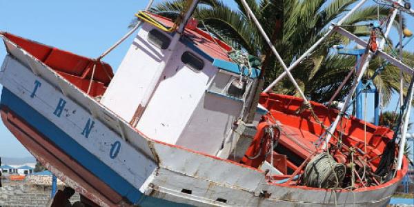
The eruption and tsunamis caused extensive destruction throughout Tonga. Damages included those on Tongatapu Island, where several beach resorts on the northwestern part of the island were leveled by the tsunami waves. The islands of Nomuka Iki, Mango, and Tonumea were also particularly hard hit, with ocean surges washing over low-lying areas. All homes on Mango Island were destroyed. The volcanic eruption itself also caused damage, including to agriculture and a seabottom fiber optic cable, but most of the $118 million (USD) in damages in Tonga were due to the tsunami.
Despite the severe destruction to many islands, only four deaths in Tonga were attributed to the tsunami. This low number of casualties was attributed to multiple factors, including the event having occurred during the day, the early arrival of moderate tsunami waves prior to the largest and most destructive wave, and the effectiveness of recent tsunami awareness education and outreach campaigns.
While the HTHH eruption generated a large local tsunami in Tonga, it also caused a massive atmospheric pressure wave that generated a series of tsunamis observed around the world.
World-wide Tsunami Warning Systems Save Lives

Since their implementation, tsunami warning systems have greatly reduced tsunami deaths in the far-field, an area defined as roughly 1,000 km (approx. 620 miles) from the tsunami source location. Tragically, two fatalities reported in Peru were the first time in over 10 years that tsunami-related deaths occurred in the far-field. In addition, damages were reported in Canada, Chile, Fiji, Japan, New Zealand, Mexico, Peru, and the United States (California, Hawaii).

Tsunami Warning Systems are primarily focused on earthquake-generated tsunamis, which make up nearly 90% of the historical tsunamis in the world, as shown by NCEI. Interim volcano tsunami alert procedures have been developed since the HTHH event. These eruptions and tsunamis have resulted in greater focus on research into volcanic source tsunamis as well as the development of interim guidance on warnings for volcanic sources, thereby improving and strengthening the global tsunami warning systems.
References
Borrero, J.C., Cronin, S., Latu’ila, F.H., Tukuafu, P., Heni, N., Tupou, A.M., Kula, T., Fa'anunu, O., Vaimounga, R., Kong, L. Field Survey of Runup and Inundation in Tonga from the January 2022 eruption of Hunga Tonga-Hunga Ha’apai Volcano. SPC Technical Report, December 2022.
International Tsunami Information Center, UNESCO/IOC-NOAA Partnership
National Geophysical Data Center / World Data Service: NCEI/WDS Global Historical Tsunami Database. NOAA National Centers for Environmental Information. doi: 10.7289/V5PN93H7


