

Tsunamis—huge ocean waves generated by sudden movements in the seafloor, landslides, or volcanic activity—have killed hundreds of thousands of people worldwide and caused billions of dollars in damage. They are equal opportunity destroyers. No coastal area in the world is entirely safe from them.
In the deep ocean, tsunami waves may only be a few inches high and often go undetected. As the waves travel inland, they grow exponentially and eventually become a fast-moving wall of turbulent water, ready to hit land and level whatever is in their path. How tsunami waves behave—how far and fast they travel—is influenced by the ridges and valleys of the ocean floor and of our coastlines.
Working in partnership with scientists from the Cooperative Institute for Research in Environmental Sciences, NCEI develops detailed coastal relief models to take the surprise out of tsunamis. These digital elevation models, or DEMs, integrate ocean depth data with coastal land elevation data to visualize relief in coastal zones.
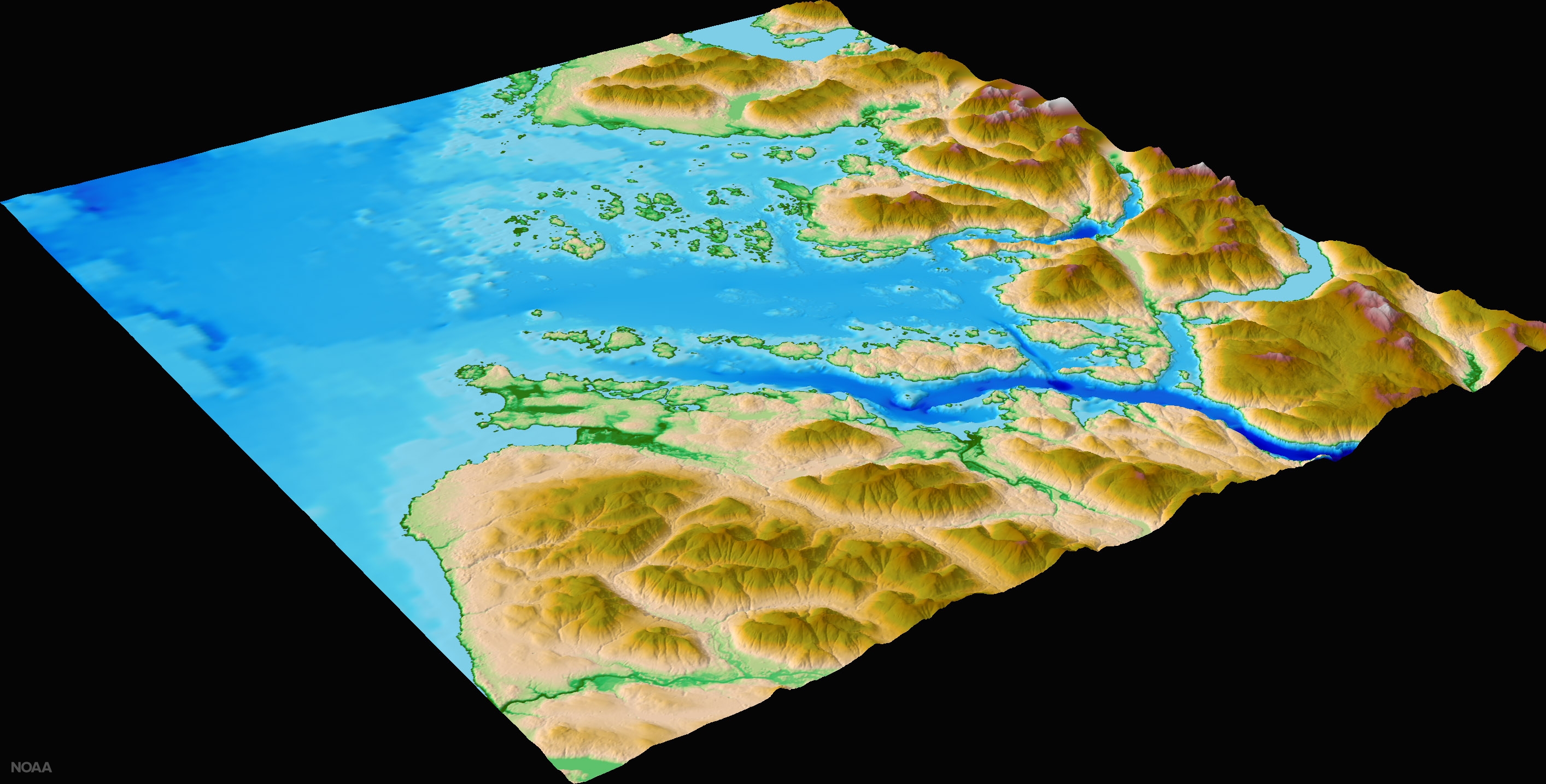 This digital elevation model image for Barkley Sound on the west coast of Canada’s Vancouver Island shows the entrance to the Port Alberni Inlet.
High-resolution DEMs are a crucial part of the U.S. Tsunami Forecast and Warning System. DEMs provide a framework that allows the NOAA Tsunami Warning Centers to more accurately predict the tsunami impact in coastal communities and ultimately save lives with better warnings. NCEI scientists have completed more than 200 models for U.S. coastal communities, including several islands in the South Pacific such as Easter Island, Rarotonga, Niue, the Galapagos, the Society Islands, and the Marquesas in French Polynesia.
Taking the Guesswork Out of Where the Waves Will Go
When scientists complete a DEM, they deliver it to the NOAA Center for Tsunami Research in Seattle where it is incorporated into tsunami models. These models simulate offshore earthquakes, the resulting tsunami movement across the ocean, and the magnitude and location of coastal flooding caused when a tsunami reaches the shore.
Armed with these simulation results, the NOAATsunami Warning Centers are then able to forecast flooding in the event of an earthquake-generated tsunami. Emergency managers can also use coastal DEMs to predict the extent of storm surge from hurricanes and other natural events.
Saving Lives Starts with Data-Sharing
The DEM team at NCEI draws on its vast archive of data about the ocean floor (known as bathymetry data) collected for navigation and ocean resource management, as well as data from other federal agencies—like the U.S. Geological Survey and U.S. Army Corps of Engineers—academia, and nonprofit organizations.
Adapted from “Tsunamis: What can the ocean floor tell us about the next disaster?”


